Profile Of Area of Operation
COOCHBEHAR
| CoochbeharDistrict, is located in north eastern part of the state and bounded by the district of Jalpaiguri and Alipurduar in the north, Dhubri and Kokrajhar district of Assam in the east and by Bangladesh in the west as well as in the south. The district has its headquarters at Coochbehar. During the British Raj, the town of Cooch Behar was the seat of a princely state of Koch Bihar, ruled by the Koch dynasty. According to the 2011 census Cooch Behar district has a population of 2,822,780 with a literacy rate of 75.49%. |  |
DARJEELING
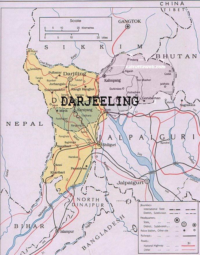
| Darjeeling, the northern most district of the state of West Bengal in the foothills of the Himalayas. The district is famous for its hill stations (often referred to as the Queen of the Hills) and Darjeeling tea. Darjeeling is the district headquarters. Kurseong, Siliguri and Mirik, three other major towns in the district, are the subdivisional headquarters of the district. It shares international boundaries with Nepal and Bangladesh. Siliguri, sub-division town of Darjeeling District, is an important commercial centre catering the needs of northern districts of West Bengal & Sikkim state. |  |
JALPAIGURI
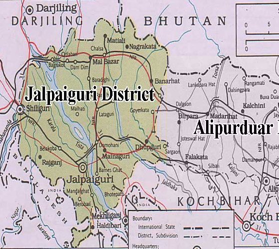
| Jalpaiguri, District has the evergreen segment of Terai & Doors. Tea Gardens & Wild life sanctuaries are the places of attraction. It is home to Gorumara National Park, which was established in 1994 and has an area of 79 km2 (30.5 sq mi). Apart from Gorumara National Park, the district contains Chapramari Wildlife Sanctuary. The District is bounded by Coochbehar & Alipurduar Districts in East, Darjeeling District in the West, International Borders of Bhutan and Bangladesh in North and South respectively. |  |
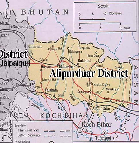
| Alipurduar District is the 20th district in the state of West Bengal, India. It consists of Alipurduar municipality and six community development blocks: Madarihat–Birpara, Alipurduar–I, Alipurduar–II, Falakata, Kalchini and Kumargram. The six blocks contain 66 gram panchayats and nine census towns. The district has its headquarters at Alipurduar. It was made a district on 25 June 2014.The District is bounded by Coochbehar District in South, Jalpaiguri District in the West, International Border of Bhutan in the North and the state of Assam in the east. |  |
KALIMPONG
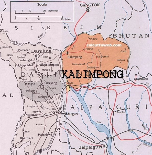
| Kalimpong District is a district in the state of West Bengal, India. It was formed on 14 February 2017, after splitting from the Darjeeling district as the 21st district of West Bengal. It consists of the Kalimpong Municipality and three community development blocks: Kalimpong I, Kalimpong II and Gorubathan. The district has its headquarters at Kalimpong. Kalimpong district is home to the Neora Valley National Park, which has an area of 159.89 km2 (61.73 sq mi). |  |
About Us
Uttarbanga Kshetriya Gramin Bank, a Regional Rural Bank sponsored by Central Bank of India, was established on the 7th March 1977 under the Provision of Section 3(2) of RRB Act 1976 [ 21 of 1976] with equity participation of Government of India (50%), Learn More about us.
Contact Us
Uttarbanga Kshetriya Gramin Bank,
Head office
Sunity Road
Po & Dist : Coochbehar
West Bengal
Pin : 736101
Phone no : 03582 229301/302
Fax : 03582 – 229306
Email : ubkgb_76@rediffmail.com
Share your feedback with us